
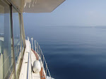
 On Saturday September 1, we made the passage from Harbor Springs to St. Ignace, which is located across from Mackinac Island at the northern terminus of the Mackinac Bridge. Because of a brisk south wind, the seas were a little rough while heading north after leaving the protection of Little Traverse Bay. But they calmed down significantly after making the eastward turn around Waugoshance Point and heading into the Mackinac Straits.
Shortly after leaving Harbor Springs, we decided to take a little detour to get a closer look at the Ile Aux Galets Light. We couldn't get too close because the island is surrounded by some pretty nasty shoals. We found the passage through the Gray's Reef area into the Mackinac Straits to be one of the most interesting stretches of Lake Michigan. For a period of time, you can see four lighthouses, the Beaver Island group to the west, shoals and islands to the east, and the tall spires of the Mackinaw Bridge in front of you. And, there was a lot of activity going on, too. A freighter was passing through the area, we started to see the ferries that go between Mackinac Island ("the Island", as it is called up here) and Mackinaw City and St. Ignace.
This is the Gray's Reef Light.
This is the old, abandoned Waugoshance Light. (This light station is allegedly haunted by the practical-jokester, wine-imbiber former lightkeeper who may or may not have fallen off a pier one night.)
Here is the St. Helena Light, on an island to the north as you approach the Mackinac Bridge.
This is the White Shoals Light. It is the only "candy striped" lighthouse on the Great Lakes. We were pretty far away from it but could still see the red and white stripes.
 We were soon in the Mackinac Straits. We approached, then passed under, the Mackinac Bridge, which is a very impressive structure. On a clear day, like the one we had, you can see it from many miles away. We could actually see the top of it rising over the Michigan mainland while we were still well south of Waugoshance Point. Then, as we neared it, it just grew larger and larger until it towered over us. Passing under it and looking up, you can see the cars and trucks through the metal gridwork over 100 feet above you . Then, you find yourself on the other side of the bridge and in Lake Huron.

We're now in St. Ignace and will write a couple of blogs about what happens when one of us (the energetic one) innocently - or at least she makes it sound that way - exclaims "Hey, let's take a short bike ride and then, if we feel up to it, take a little stroll across the bridge."
Monday, September 3, 2007
Through the Mackinac Straits to St. Ignace, Michigan


Thursday, August 30, 2007
Beaver Island, Michigan
 On Sunday (August 26, 2007) we cruised out to Beaver Island from Charlevoix.
Beaver Island is the largest and most isolated of the inhabited islands on Lake Michigan. Saint James Harbor, which is at the northern end of the island, is over 30 miles out from Charlevoix.
When we left Charlevoix, the lake was kind of rough. But the waves were coming from the northwest, so we hoped it would become calmer as we neared the island. And it did.
Bernie got to be the captain for a while during this portion of the trip. Here's a picture of her transporting the herb garden out to Beaver Island. During the trip out, we passed the Beaver Island Ferry (The "Emerald Isle") heading back to Charlevoix. As you can see, she's a pretty good size, built to take some rough seas. It's a nice looking ferry.
 When arriving at St. James Harbor, there's the St. James Harbor Lighthouse out at the point.
 And here it is at night with an almost-full moon.
 Much of St. James Harbor is very shallow, and there's a channel running from the southern to the northern part of the harbor that's marked with buoys. But even when you get to the northern part, there are shallows to watch out for. One of them, marked as four feet on the charts, is right off of the Beaver Island Marina, which is where we stayed. We kept away from the shallowest part, but as we were approaching the slip our depth sounder (which has an alarm set at five feet) started chirping like crazy. At one point, it read 3.6 feet - which was worrisome, as Meridian has a draft of about 3.5. But with the transponder about 1 1/2 feet under water, that still gave us plenty of clearance.
When we arrived in the marina, the harbor was perfectly calm and it was a sunny day. The water was crystal clear. Here's a view of the harbor bottom from the bridge of Meridian. The water there is about six feet deep.
In keeping with the rest of Beaver Island, the Beaver Island Marina is pretty basic. No luxuries here, but all you really need. And they have a garage where they do mechanical work, so when Phil changed the oil on Tuesday - and used up his supply - he was able to buy a couple of spare quarts of synthetic (they carry Amsoil) from them. They also recycle and ask that you separate paper, glass, plastic, cans, and other - which we happily did.
 What we immediately noticed about Beaver Island was just how quiet it was. Very different from the busy resort atmosphere of Charlevoix. There are very few cars and those you encounter tend to travel slowly. That first day, the loudest spot on the island seemed to be our boat, with a few ripples lapping against Meridian's hull creating the only sounds. Once on the island, there was this incredible silence that lulls you into a sense of total relaxation. We found ourselves talking in whispers much of the time!
Here's the view of the harbor during sunset. It was as peaceful as the photo appears. Beaver Island has a very interesting and unique history. During the mid 1800's, a group of Mormons settled on the island. They eventually drove all non-Mormons away and started building a community. They were led by James Strang who pronounced himself King. Yes, Beaver Island was actually (sort of) a Kingdom for a while. King Strang was assassinated by two of his "subjects" (who were quickly whisked away to safety on the mainland by a ship that just happened to be there at the time) in 1856. Land speculators from the mainland - who wanted to get their hands on the improved land the Mormons had cleared and cultivated - then instigated an angry mob who came over from the mainland and drove the Mormons away.
 After the Mormons left - here's the great part - a boatload (literally) of Irish arrived on the island. They came from Arranmore Island in County Donegal, after having been kicked off of their land there. They settled the island and, to this day, there is a huge Irish influence with many of their descendants still on the island. Many of the roads and bays are named for the early Irish settlers, and Gaelic signs abound. Unfortunately, one of the ancestral McCauleys was apparently wanted for excessive noisemaking. When the marina reported a "McCauley" had checked in, well ... it seems the descendents have to pay the dues of the previous generations.
Here's a photo of
<<<<<<
We interrupt this blog to bring you this special report
As I (Phil) write this in Harbor Springs, Bernie has suddenly taken it upon herself to begin washing the outside of Meridian. Yes, Bernie is literally swabbing the deck as I type!!!
It's taken over four years to get to this point.
BERNIE IS CLEANING THE BOAT!!!!!!!!!!!!
YESSSSS!!!!!!!!!!!!!!!!
Ok, back to the blog . . . .
Here's a photo of one of the Irish street names. Did you really think we wouldn't capture this one on film??? And here's Bernie, at the entrance to the Donegal Bay bike path. Note the shamrock.
 This bike path is interesting because it's paved. Almost all of the island's roads are dirt or gravel. But they do have their priorities - the Donegal Bay Bike Path is paved (left), while Donegal Bay Road (right), for cars, next to it is still a gravel road! They are planning more paved bike paths on the island.
 It's about 35 miles to go completely around the island by bicycle - which we did. The views along the way are worth the variations in gravel roads. (One of the museums mentioned that they had a greyhound bus on the island once. It came over on the ferry, met a car on West Side Drive, a very narrow gravel road, left on the ferry and never came back.) OK, there's a short section that is very sandy - the price you pay for the view of the sand dunes. Besides, it wouldn't be a bike ride if we didn't have to walk the bikes through some sand for a portion of it ;)
Here's a photo of Donegal Bay . . . one of the more popular beaches on the island . . .
 The old brick Beaver Island Head Light, which is at the southern end of the island, was restored by a Charlevoix school youth employment program. They purchased it for $1 and have worked on restoring it - it had been vandalized since it wasn't being used nor maintained. They've done a great job - the "before" pictures showed some grafitti and holes in walls. You are now able to climb the stairs to the tower (which is 103 feet above the water surface - according to the signs.)
 From the top of the lighthouse you can see the chimneys from the house. Someone has placed stones on the corners of the chimney. It apparently wasn't Monk as the fourth one is missing.
And of course a McCauley Point ... to go along with the Road and the Bay ... And here's a home we happened upon . . . with a close-up of the signs by the door. Click on the photos to read the detail.


The island boasts 2 museums - the historical museum and the maritime museum. The maritime museum is in an old fish shack and has some great pieces including this life boat from the Carl Bradley -a large freighter that sunk in Lake Michigan, an old WPA mural from the 1930s that was rescued from a building being demolished, and an old fishing boat that is being restored but is open to the public.

One thing we have to mention about Beaver Island is how friendly everyone is. Most people in cars wave at you as they pass by. There was even a newsclipping on the marina wall about a cruiser who, upon spending several days on Beaver Island, thought he must look like someone living there because "everyone waved at me".
Well, ok, they don't wave if you are limping ...
Wednesday, August 22, 2007
South Manitou Island to Northport Michigan
 This leg of the trip is about 45 miles. We left South Manitou at about 7:30 am on Sunday morning and arrived at G. Marsten Dame Marina in Northport at about 1:00 pm. The trip was fairly uneventful. We didn't see too many boats along the way, but we're starting to hear more radio chatter from the "real" cruisers who are doing the Great Loop cruise. They seem to be traveling in groups, talking to each other a lot, and comparing where each had waited out the recent windy spell.
We stayed about five miles offshore most of the time, and the water was relatively calm except for a brief spell as we neared Lighthouse Point. Lighthouse Point marks the northeast end of Grand Traverse Bay. The wind picked up and it got a bit choppy, but it never got too bad. It calmed down after entering Grand Traverse Bay.
The Grand Traverse Lighthouse is on Lighthouse Point. While staying in Northport we took a bicycle ride to the lighthouse. As we were rounding the point, we saw a large freighter. It was far out on the lake, with South Fox Island in the background.
As we entered the marina, once again the staff was waiting at the slip to help us with the lines. We tied up, got Meridian situated, thanked Meridian for giving us a safe and comfortable ride, then left to explore the town.
Tuesday, August 21, 2007
South Manitou Island
 After paying a visit to Leland Harbor's gas dock ($3.50 / gallon), we left for South Manitou Island at about 10:00 am. At our sound-barrier-busting speed of 8.5 knots, it took us a little under two hours to reach the island’s sheltered bay.
South Manitou Island lies out in Lake Michigan about 15 miles east of Leland. About halfway there from Leland you pass the North Manitou lighthouse. It's out in the middle of the channel marking a shoal. It's kind of desolate looking, with mean-looking black birds sitting on all available perches.

South Manitou is isolated, has no permanent residents, and has no dockage for recreational boats – only a very sheltered sandy bay that provides good protection from the wind in all directions except the northeast. This would be the first time we ever anchored over night.
Our first attempt at anchoring yielded a clump of weeds that clung to the anchor and caused it to drag across the bottom. Luckily, the bay was calm and no other boats were within a hundred yards or so of us. While pulling up the anchor to try again, we realized the water was so clear that, even at twenty feet deep, we could look down and find a nice sandy spot to drop the anchor. Our second attempt was successful.
We had some interesting neighbors in the anchorage. A tall ship was there when we arrived. It soon weighed anchor and motored away though. Was it something we said? They still hadn’t raised sail even as they rounded Pyramid Point and headed south.


After convincing ourselves that the anchor was holding (you should have seen us staring at the GPS, writing down all the coordinates as the boat swung on the anchor line, attempting to verify that, yes, it was just swinging in an arc and not dragging backwards!) we celebrated with a sip of Anguill1an rum (Pyrat). We then jumped in the dinghy and went ashore. (Phil left out the part about how Bernie was serenely napping on the bow of Meridian in the warm afternoon sun when he abruptly announced “Let’s go ashore now. There’s not a moment to lose! Get up! Chop! Chop!” Although he said he was trying to be funny, Bernie was not amused.)


It was impossible to walk away without taking some more photos of Meridian at anchor. We have seldom (maybe never) actually seen her on the open water from a distance. Hey, that’s a
nice looking boat!


From that last photo of Meridian at anchor, you start to see the crescent shape of the harbor. It’s a perfect arc with a sandy beach stretching the entire length of the harbor. Ok, a pebbly sandy beach.

But the water is incredibly clear. In this photo, the water was perfectly calm. Yes, those pebbles are under water.

We had high hopes for spotting wildlife on South Manitou. Now, we didn’t realistically expect to see a bear or a moose (maybe we’ll see those from the water farther up north?). But we had heard from a reliable commenter that there was a strong possibility of a manatee sighting.
And we think we saw one. Is this what a manatee and her babies look like? My they have big families – there are about fifteen little “manatees” following the mother.

During our hike along the beach, we passed the old dock, in use years ago before the island was abandoned.

We also passed an interesting item that washed up along the beach. Phil thought we could salvage it, then tow it along and use it as a life raft in case stormy weather hit. Bernie wasn’t so sure and, as usual, her good sense won out. You can see the ferry from Leland docked in the background.

At the east end of the harbor is the old abandoned lighthouse. Due to it’s location on the Manitou Passage, which is the major north/south route for ships traveling Lake Michigan, there was a spell in the mid 1800s where South Manitou had the only (maybe the first?) light operating on Lake Michigan.

Here’s a view of Lake Michigan from the lighthouse.

South Manitou is officially part of the Sleeping Bear Dunes National Lakeshore. The visitor’s center near the light house tells the legend of Sleeping Bear.

From the lighthouse, we took a hike through the heart of the island. Bernie did some experimenting with her camera taking nature photos.


South Manitou was inhabited for many years, first as a major stopping point for wooden ships as a harbor of refuge, then to pick up timber for steamships, then finally as a farming outpost. It’s been abandoned for many years now, though, and the island is reclaiming most of the old buildings. If you look closely, you can sometimes see the remains of old structures and various implements scattered about. Some are marked with plaques. Others are not.


This building was in the woods near the old dock. If you look closely, you see one whole side of it, from ground to roof, lying flat on the ground.

The sign posted nearby warned us “This building is closed to the public . . . do not enter”. We’re not sure how one would enter it!
 After returning to the boat we spent the evening at anchor. There were seven or eight other boats anchored in the harbor and it was comforting to see their anchor lights at night. Even so, we didn’t sleep very well. The wind had picked up from the east, blowing toward shore and - did we mention this was our first time anchoring overnight? - we were still worried about the anchor dragging. So we kept a GPS by the bed with the anchor alarm set.
Of course nothing bad happened and we were greeted by a very nice sunrise.

We weighed anchor in the morning (hard to read the scale, but we think it gained a few pounds) and began the trip to Grand Traverse Bay. Our destination was Northport Harbor.