
 After paying a visit to Leland Harbor's gas dock ($3.50 / gallon), we left for South Manitou Island at about 10:00 am. At our sound-barrier-busting speed of 8.5 knots, it took us a little under two hours to reach the island’s sheltered bay.
South Manitou Island lies out in Lake Michigan about 15 miles east of Leland. About halfway there from Leland you pass the North Manitou lighthouse. It's out in the middle of the channel marking a shoal. It's kind of desolate looking, with mean-looking black birds sitting on all available perches.

South Manitou is isolated, has no permanent residents, and has no dockage for recreational boats – only a very sheltered sandy bay that provides good protection from the wind in all directions except the northeast. This would be the first time we ever anchored over night.
Our first attempt at anchoring yielded a clump of weeds that clung to the anchor and caused it to drag across the bottom. Luckily, the bay was calm and no other boats were within a hundred yards or so of us. While pulling up the anchor to try again, we realized the water was so clear that, even at twenty feet deep, we could look down and find a nice sandy spot to drop the anchor. Our second attempt was successful.
We had some interesting neighbors in the anchorage. A tall ship was there when we arrived. It soon weighed anchor and motored away though. Was it something we said? They still hadn’t raised sail even as they rounded Pyramid Point and headed south.


After convincing ourselves that the anchor was holding (you should have seen us staring at the GPS, writing down all the coordinates as the boat swung on the anchor line, attempting to verify that, yes, it was just swinging in an arc and not dragging backwards!) we celebrated with a sip of Anguill1an rum (Pyrat). We then jumped in the dinghy and went ashore. (Phil left out the part about how Bernie was serenely napping on the bow of Meridian in the warm afternoon sun when he abruptly announced “Let’s go ashore now. There’s not a moment to lose! Get up! Chop! Chop!” Although he said he was trying to be funny, Bernie was not amused.)

It was impossible to walk away without taking some more photos of Meridian at anchor. We have seldom (maybe never) actually seen her on the open water from a distance. Hey, that’s a
nice looking boat!


From that last photo of Meridian at anchor, you start to see the crescent shape of the harbor. It’s a perfect arc with a sandy beach stretching the entire length of the harbor. Ok, a pebbly sandy beach.

But the water is incredibly clear. In this photo, the water was perfectly calm. Yes, those pebbles are under water.
![]()
We had high hopes for spotting wildlife on South Manitou. Now, we didn’t realistically expect to see a bear or a moose (maybe we’ll see those from the water farther up north?). But we had heard from a reliable commenter that there was a strong possibility of a manatee sighting.
And we think we saw one. Is this what a manatee and her babies look like? My they have big families – there are about fifteen little “manatees” following the mother.

During our hike along the beach, we passed the old dock, in use years ago before the island was abandoned.

We also passed an interesting item that washed up along the beach. Phil thought we could salvage it, then tow it along and use it as a life raft in case stormy weather hit. Bernie wasn’t so sure and, as usual, her good sense won out. You can see the ferry from Leland docked in the background.

At the east end of the harbor is the old abandoned lighthouse. Due to it’s location on the Manitou Passage, which is the major north/south route for ships traveling Lake Michigan, there was a spell in the mid 1800s where South Manitou had the only (maybe the first?) light operating on Lake Michigan.

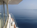
Here’s a view of Lake Michigan from the lighthouse.

South Manitou is officially part of the Sleeping Bear Dunes National Lakeshore. The visitor’s center near the light house tells the legend of Sleeping Bear.

From the lighthouse, we took a hike through the heart of the island. Bernie did some experimenting with her camera taking nature photos.


South Manitou was inhabited for many years, first as a major stopping point for wooden ships as a harbor of refuge, then to pick up timber for steamships, then finally as a farming outpost. It’s been abandoned for many years now, though, and the island is reclaiming most of the old buildings. If you look closely, you can sometimes see the remains of old structures and various implements scattered about. Some are marked with plaques. Others are not.


This building was in the woods near the old dock. If you look closely, you see one whole side of it, from ground to roof, lying flat on the ground.

The sign posted nearby warned us “This building is closed to the public . . . do not enter”. We’re not sure how one would enter it!
 After returning to the boat we spent the evening at anchor. There were seven or eight other boats anchored in the harbor and it was comforting to see their anchor lights at night. Even so, we didn’t sleep very well. The wind had picked up from the east, blowing toward shore and - did we mention this was our first time anchoring overnight? - we were still worried about the anchor dragging. So we kept a GPS by the bed with the anchor alarm set.
Of course nothing bad happened and we were greeted by a very nice sunrise.

We weighed anchor in the morning (hard to read the scale, but we think it gained a few pounds) and began the trip to Grand Traverse Bay. Our destination was Northport Harbor.
1 comment:
is manitou the plural of manatee? i bet Di knows ;-)
Post a Comment