
 On Sunday (August 26, 2007) we cruised out to Beaver Island from Charlevoix.
Beaver Island is the largest and most isolated of the inhabited islands on Lake Michigan. Saint James Harbor, which is at the northern end of the island, is over 30 miles out from Charlevoix.
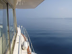
When we left Charlevoix, the lake was kind of rough. But the waves were coming from the northwest, so we hoped it would become calmer as we neared the island. And it did.
Bernie got to be the captain for a while during this portion of the trip. Here's a picture of her transporting the herb garden out to Beaver Island. During the trip out, we passed the Beaver Island Ferry (The "Emerald Isle") heading back to Charlevoix. As you can see, she's a pretty good size, built to take some rough seas. It's a nice looking ferry.
 When arriving at St. James Harbor, there's the St. James Harbor Lighthouse out at the point.
 And here it is at night with an almost-full moon.
 Much of St. James Harbor is very shallow, and there's a channel running from the southern to the northern part of the harbor that's marked with buoys. But even when you get to the northern part, there are shallows to watch out for. One of them, marked as four feet on the charts, is right off of the Beaver Island Marina, which is where we stayed. We kept away from the shallowest part, but as we were approaching the slip our depth sounder (which has an alarm set at five feet) started chirping like crazy. At one point, it read 3.6 feet - which was worrisome, as Meridian has a draft of about 3.5. But with the transponder about 1 1/2 feet under water, that still gave us plenty of clearance.
When we arrived in the marina, the harbor was perfectly calm and it was a sunny day. The water was crystal clear. Here's a view of the harbor bottom from the bridge of Meridian. The water there is about six feet deep.![]()
In keeping with the rest of Beaver Island, the Beaver Island Marina is pretty basic. No luxuries here, but all you really need. And they have a garage where they do mechanical work, so when Phil changed the oil on Tuesday - and used up his supply - he was able to buy a couple of spare quarts of synthetic (they carry Amsoil) from them. They also recycle and ask that you separate paper, glass, plastic, cans, and other - which we happily did.
 What we immediately noticed about Beaver Island was just how quiet it was. Very different from the busy resort atmosphere of Charlevoix. There are very few cars and those you encounter tend to travel slowly. That first day, the loudest spot on the island seemed to be our boat, with a few ripples lapping against Meridian's hull creating the only sounds. Once on the island, there was this incredible silence that lulls you into a sense of total relaxation. We found ourselves talking in whispers much of the time!
Here's the view of the harbor during sunset. It was as peaceful as the photo appears. Beaver Island has a very interesting and unique history. During the mid 1800's, a group of Mormons settled on the island. They eventually drove all non-Mormons away and started building a community. They were led by James Strang who pronounced himself King. Yes, Beaver Island was actually (sort of) a Kingdom for a while. King Strang was assassinated by two of his "subjects" (who were quickly whisked away to safety on the mainland by a ship that just happened to be there at the time) in 1856. Land speculators from the mainland - who wanted to get their hands on the improved land the Mormons had cleared and cultivated - then instigated an angry mob who came over from the mainland and drove the Mormons away.
 After the Mormons left - here's the great part - a boatload (literally) of Irish arrived on the island. They came from Arranmore Island in County Donegal, after having been kicked off of their land there. They settled the island and, to this day, there is a huge Irish influence with many of their descendants still on the island. Many of the roads and bays are named for the early Irish settlers, and Gaelic signs abound. Unfortunately, one of the ancestral McCauleys was apparently wanted for excessive noisemaking. When the marina reported a "McCauley" had checked in, well ... it seems the descendents have to pay the dues of the previous generations.
Here's a photo of
<<<<<<
We interrupt this blog to bring you this special report
As I (Phil) write this in Harbor Springs, Bernie has suddenly taken it upon herself to begin washing the outside of Meridian. Yes, Bernie is literally swabbing the deck as I type!!!
It's taken over four years to get to this point.
BERNIE IS CLEANING THE BOAT!!!!!!!!!!!!
YESSSSS!!!!!!!!!!!!!!!!
Ok, back to the blog . . . .
Here's a photo of one of the Irish street names. Did you really think we wouldn't capture this one on film??? And here's Bernie, at the entrance to the Donegal Bay bike path. Note the shamrock.
 This bike path is interesting because it's paved. Almost all of the island's roads are dirt or gravel. But they do have their priorities - the Donegal Bay Bike Path is paved (left), while Donegal Bay Road (right), for cars, next to it is still a gravel road! They are planning more paved bike paths on the island.
 It's about 35 miles to go completely around the island by bicycle - which we did. The views along the way are worth the variations in gravel roads. (One of the museums mentioned that they had a greyhound bus on the island once. It came over on the ferry, met a car on West Side Drive, a very narrow gravel road, left on the ferry and never came back.) OK, there's a short section that is very sandy - the price you pay for the view of the sand dunes. Besides, it wouldn't be a bike ride if we didn't have to walk the bikes through some sand for a portion of it ;)
Here's a photo of Donegal Bay . . . one of the more popular beaches on the island . . .
 The old brick Beaver Island Head Light, which is at the southern end of the island, was restored by a Charlevoix school youth employment program. They purchased it for $1 and have worked on restoring it - it had been vandalized since it wasn't being used nor maintained. They've done a great job - the "before" pictures showed some grafitti and holes in walls. You are now able to climb the stairs to the tower (which is 103 feet above the water surface - according to the signs.)
 From the top of the lighthouse you can see the chimneys from the house. Someone has placed stones on the corners of the chimney. It apparently wasn't Monk as the fourth one is missing.
And of course a McCauley Point ... to go along with the Road and the Bay ... And here's a home we happened upon . . . with a close-up of the signs by the door. Click on the photos to read the detail.


The island boasts 2 museums - the historical museum and the maritime museum. The maritime museum is in an old fish shack and has some great pieces including this life boat from the Carl Bradley -a large freighter that sunk in Lake Michigan, an old WPA mural from the 1930s that was rescued from a building being demolished, and an old fishing boat that is being restored but is open to the public.

One thing we have to mention about Beaver Island is how friendly everyone is. Most people in cars wave at you as they pass by. There was even a newsclipping on the marina wall about a cruiser who, upon spending several days on Beaver Island, thought he must look like someone living there because "everyone waved at me".
Well, ok, they don't wave if you are limping ...
Thursday, August 30, 2007
Beaver Island, Michigan
Wednesday, August 29, 2007
Charlevoix
 From the marina, you immediately notice the large Victorian-style houses along the hill. Charlevoix is probably the first town we've visited that was originally a resort and vacation area. And there are examples of the Victorian architecture throughout the town. But, there is also some very unique architecture here as well. While at the Chamber of Commerce, always a first stop, we picked up a brochure on "The Earl Young Tour of Charlevoix". Victorian is nice, but the Earl Young houses are really interesting. Back in the 1930s, Mr. Young had bought a lot of property on the west edge of Charlevoix, which he developed with winding roads and several houses. Eleven seem to still exist in the area and there are a few others scattered in town. The pictures to the left are two that are along the river.
 This is the front and back of the same house. You have to look closely but even the birdhouse is stone with the cedar roof. The brochure says that he designed the house to fit the space. We'd love to see what the inside of these homes look like. Phil thought that we had wandered into Hobbit-town.
This is called the Mushroom House.

The Woolly Bugger Roasters of Fine Coffees and Internet Cafe has free wi-fi. It also has the "Lake Effect", a White Chocolate Coffee drink, that is rather addicting. There's a Woolly Bugger in Harbor Springs (which we'll write about soon). Phil thinks Bernie just likes the name, which refers to a type of fly fishing lure. But she also thinks that all the fishing related quotes around the wall, free internet are pretty neat. Did I mention that the Lake Effect was tasty? And Phil really liked the Ethiopean and the Inn at Crooked Lake Blend.
A quick mention of the Great Lakes Whitefish and Chips Co. is necessary since we ate there both nights. You can't be up here without enjoying the whitefish. Oh, and Murdick's Fudge shop also fulfilled our "Ice cream in every port" rule. They have Sleeping Bear Supreme Ice Cream. Charlevoix has a good bike path, too. The Little Traverse Wheelway is an old railroad path that runs from Charlevoix all the way to Harbor Springs (about 19 miles one way). It's all paved but there are some pretty steep hills (that were definitely NOT part of a rail road line). But, hey, every now and then you should go through each of your 24 gears to make sure they all work. Or as Phil says "You got 24 gears - use 'em".


 We didn't get to the Historical museum, this time, but we did check out some of their historical markers. We live along Lake Michigan but coming up here gives you an entirely different view of the lake and the history that goes with it.
Also while in Charlevoix we met another couple who have a Chris Craft, too. (Actually, they were our neighbors -- we've noticed that the harbor masters tend to put us next to other Chris Crafts if possible.) They live in Florida during the winter and live on their boat in various Michigan harbors the whole summer. They store their boat for the winter in whatever port they are in when the weather "turns". That doesn't sound like a bad plan to us at all!

"Looks like we got us a convoy" as we left Charlevoix for Beaver Island.
Tuesday, August 28, 2007
Heading off to Charlevoix
 On Friday morning (August 24), we gassed up at Traverse City ($3.53 / gallon) then headed for Charlevoix. The trip up Grand Traverse Bay was uneventful, with the weather sunny and calm. Some Chicago boaters may recognize the large blue boat also in the picture -- it's from DuSable Harbor. It had some crewmembers from Pendragon (also DuSable) that were in town for a regatta.
When leaving Grand Traverse Bay headed to the northeast, you pass Fisherman’s Island. There are some shoals there to avoid, so you shouldn’t get too close. Past Fisherman’s Island, there’s a buoy marking the dangerous areas and you should stay outside of it. At this point, there were a number of sailboats heading out, as well as into, Charlevoix, and we kept close to the buoy to avoid them.
Upon rounding the point and approaching the river channel of Charlevoix, it got pretty choppy. This area of Lake Michigan around the Charlevoix was much rougher than the surrounding areas on the way out as well. It may be because of the interaction with the river current and the breakwaters. But it wasn’t too terribly bad and we made it into the channel with ease. Once in the river, we could really feel the current affecting our forward motion. But it slowed down considerably by the time we neared the bridge, and it was easy to hold Meridian stable as we waited for the bridge to open. This time of year, it opens every half hour and you don’t have to signal.
 After getting through the bridge, we hailed Charlevoix Municipal Marina, got our slip assignment, and pulled safely in to the harbor. Charlevoix Municipal Marina is currently undergoing an extensive reconstruction. They have nice floating docks (the rickety ladder gets another workout) and electricity, but there is no water. And there are no facilities at the harbor. The harbor master’s office is temporarily located over by the Beaver Island Ferry offices, and those restrooms are open 24 hours for boaters. However, they don’t have showers. They give a $5 per night discount for the lack of water or showers. That is supposed to make up for having to pay for showers at the health club. But when we went to the health club on Saturday afternoon, it was closed. Luckily, we had filled up the water tanks in Traverse City. We took very short showers on Meridian.
One thing that surprised us about the slips was that there were no poles between slips. Not even for the largest boats. That means there is no way to keep the boat off the dock when the wind blows from a certain directions. The fenders – and/or fender boards - can get a decent workout here. However, the wind wasn’t much of a problem because Round Lake is a small lake surrounded by high hills. And the entire lake is a no wake zone.
While the harbor and park are not much to look at now, we’re told they’ll be extremely nice once completed. And if they’re to be anything like the rest of Charlevoix that we experienced, they will be first-rate. While we were staying in Charlevoix, we saw a large sailboat (The “Lady Carol”) arrive and sail on through Round Lake into Lake Charlevoix. That was a coincidence, because we stayed in their slip when in Northport. We know the boat because, when in Northport, they arrived and had to tie up on the wall while we were there. It was so windy at the time, the harbor master didn’t ask us to move for them (did we mention that the harbor staff at these marinas are great?).
Traverse City
 I think we've mentioned that Traverse City is the largest port we've been in so far. They have a very developed downtown area (Front Street is the main street) with home-furnishing and outdoor sports focused stores in addition to the souvenir-type shops and restaurants. They have two food stores in the general area of the marina, although as Phil found out - Tom's Market is much further on foot than it appears to be via bicycle ;). Folgarelli's Market has more of the gourmet type items and a very large selection of specialty cheeses and wines (local and other). We enjoyed the ice cream - very large dishes of Sleeping Bear Supreme's Cherry Chocolate - at the Cherry Stop and sampled the local brews at the Mackinaw Brewing Company (but not at the same time). Traverse City has a good independent book store - Horizon Books.
 We also visited The Grand Traverse Heritage Center. In addition to its standard exhibits about life in Traverse City in the early days, they were showing an exhibit on Mysteries of the Great Lakes. This exhibit talked about waterspouts, St. Elmo's Fire (the weather event, not the movie), ghost ships and pirates. Apparently there was one pirate who went around robbing ships and took his ill-gotten gains to Chicago where "he could easily unload them".
 Their regular exhibits show a room in the old Northern Michigan Asylum and a schoolhouse scene. The schoolhouse scene also listed the rules for teachers. Pretty strict - especially the one about not being able to loiter in the ice cream shop! That's cruel and unusual punishment!
The TART trail also connects to two other trails and is a nice ride with interesting sites along the way. The TART Trail is paved. The Leelanau Trail is not paved but is crushed gravel.


As you can see, there is quite a lot to do there between the bike trails, shops, markets, wineries and museums. We could have easily stayed a fourth night and will be looking forward to visiting the area again.