
 Turnbull Island was our first planned anchorage spot. We had heard that navigating the North Channel required careful piloting so we made sure we were prepared. Hopefully, two GPS units, two compasses, a depth sounder, binoculars, and charts are enough.
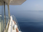
Turnbull Island was a good first anchorage for us. We had a nice spot close to shore and it wasn't too crowded -- perhaps ten other boats, all sailboats except for one other power boat.
Turnbull Harbor has two anchorages: North and South. The North Anchorage, where we anchored in about 10 feet of water, is well protected, not weedy, and has depths of 8 to 10 feet, shelving to 5 feet. You do have to be careful of at least one deadhead that is near the shore. (No, this is not an old fan of the Grateful Dead who sings Scarlet Begonias all night long. A deadhead is a large log, left from the old timber days, embedded under water. Very nasty.) The South Anchorage is more exposed to the southwest winds and has depths of 10 to 14 feet, shelving to 5 feet.
We found the north anchorage to be sufficiently secure -- even without a second anchor -- although we never want to be too complacent as the "Port Sheldon Incident" is still fresh in our minds.
It was also the first real test of the kayak launching procedure that we practiced in Meldrum Bay. In Meldrum Bay, we still had the dock to keep us steady, but this was the first afloat launching.
It was easier than the dock, as it turned out, because we didn't have to worry about banging the kayak onto a hard surface -- it splashed gently into the water as we lowered it. We then took the kayak for a walk around to Meridian's stern, secured the kayak to the dinghy and boarded it from there.
(Sorry, Bill, but your suggestion of sitting in the kayak while it's still on Meridian's bow and pushing ourselves over didn't work too well. The kayak's keel stuck in the bow rail and we were left dangling over the side at a 45 degree angle. We had to unceremoniously crawl back up the kayak into Meridian as all those sailboaters at anchor laughed at us.)
After getting it situated, we kayaked around Turnbull Harbor and out among the surrounding islands. Turnbull is at the eastern end of a small archipelago of islands, all very rocky and picturesque. Phil doesn't get to see the view all that much though, because when kayaking he sits in the stern and must focus on continually adjusting his paddling speed, stroke and direction to whatever Bernie happens to feel like doing at the time.


 Turnbull Island is a narrow U-shaped island, and if you look carefully enough, you can find some hiking trails that lead from the sand beach area of the anchorage to the other side of the island. Phil was lucky enough to notice one, and it led to a beautiful little bay with a small gravel beach surrounded on either side by boulders and bluffs.
We decided our next stop would be Long Point Cove. The cove does not have an official name, but everyone seems to know it by this name. It's a hidden cove that requires identifying a certain island to find the entrance. Then you have to knock 3 times on a pink rock and yell SHAZAM for the opening to appear.
Phil thinks that when we get to Long Point Cove, we might finally be "there".
Monday, July 21, 2008
Turnbull Island - Are We "There" Yet?
![]()
![]()
Subscribe to:
Post Comments (Atom)
No comments:
Post a Comment